
How to Verify Your Boundary Before the Fence Posts Go In
Boundary work should retrace the relevant line and mark it for the installer. Ask whether intermediate points along the proposed run are included.
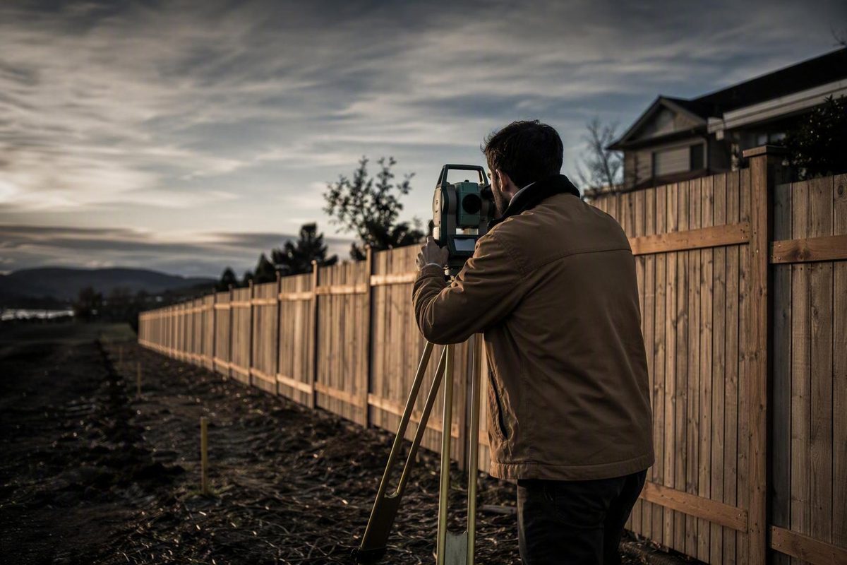
A property survey is not mandatory for every fence project. Permit and survey requirements vary by location and project, so the first step is to ask the local building or zoning office what documents are required. Even when a new survey is not legally required, licensed boundary work is often the most reliable basis for placement when the property line is uncertain, records conflict, markers are missing, or the fence will run close to the apparent boundary.
Before construction, answer four separate questions:
- Where does your ownership end?
- Where do zoning, permit, and private rules allow the fence?
- Do easements or other recorded rights constrain the route?
- Where can excavation occur safely?
A boundary survey principally addresses the first question and may provide evidence relevant to the others. It does not approve the fence, interpret every private restriction, or replace underground-utility marking.
Do You Need a Property Survey Before Building a Fence?
No—not universally. Whether a survey is required depends on the local permit process, the fence’s location and design, and the documents available for the property. Commercial surveying guidance also recognizes that survey requirements depend on local rules and property conditions rather than applying to every fence project (Pahrump Land Surveying).
“Fence property survey” is not necessarily a standardized service name. Describe the project to a surveyor licensed in the state where the property is located and ask what scope is appropriate. Depending on local terminology and the available records, that work might be described as:
- Boundary survey
- Boundary retracement
- Survey update
- Corner recovery
- Property-line staking
- Fence-line staking
The deliverables matter more than the label. You need enough professional work to determine or retrace the relevant boundary and transfer that information to the ground in a form the installer can follow.
When licensed boundary verification is advisable
Consult a licensed surveyor when:
- You cannot confidently locate the relevant property corners.
- Markers are missing, damaged, disturbed, or inconsistent.
- The deed, plat, prior survey, closing document, and visible features do not agree.
- The fence will be on or close to the apparent property line.
- An easement may affect the proposed route.
- A neighbor disputes your understanding of the boundary.
- The parcel has an unusual shape or complicated legal description.
- The permit office asks for professionally prepared boundary information.
- You intend to remove an old fence that may be near the boundary.
A surveyor may compare deeds, plats, prior surveys, monuments, occupation evidence, and field measurements instead of relying on one clue. This is important because visible occupation—such as an existing fence or mowing pattern—does not necessarily coincide with the recorded boundary.
When existing documents may support initial planning
A suitable prior boundary survey may help if:
- It covers the correct parcel.
- The parcel has not since been divided, combined, adjusted, or partly conveyed.
- The document is legible.
- Its referenced corners or monuments can still be recovered.
- Current conditions do not reveal an unexplained conflict.
- A licensed surveyor determines that verification, updating, or limited staking will be sufficient.
Existing records can support early design discussions, budgeting, and permit inquiries. They should not automatically be treated as construction layout instructions, however. Transferring bearings and distances from a drawing to the ground may require professional interpretation and field measurements.
Why an existing fence is not proof
Replacing a fence along its old route does not prove that the route follows the legal boundary.
The same caution applies to:
- Hedges and tree lines
- Retaining walls
- Driveways
- Mowing patterns
- Aerial photographs
- Phone GPS readings
- A neighbor’s recollection
These features can be evidence of how land has been occupied, but no single feature should be treated as a verified construction line.
A fence extending onto neighboring land may have to be moved or removed and may lead to a dispute, permit complications, or reinstallation expense; the actual outcome depends on local law and the property-specific facts. Surveying guidance addressing fence placement makes the same qualified warning about possible relocation and disputes (Pahrump Land Surveying).
The practical rule is straightforward: the closer the proposed fence is to the assumed line, the less room there is for assumption.
Which Survey or Property Record Is Suitable for Fence Placement?
Not every document called a “survey” was prepared for construction layout. An official-looking map can be useful for research without being suitable for locating fence posts.
| Survey, record, or feature | What it may provide | How to use it for a fence |
|---|---|---|
| Boundary survey | Professional determination or retracement of parcel limits using records, field evidence, measurements, and calculations | Generally the most relevant foundation when accurate placement near a boundary is needed |
| Boundary update or retracement | Reassessment of earlier boundary work and recovery of existing evidence | May be efficient when a suitable prior survey exists; confirm what will be reverified and marked |
| Line staking | Stakes, flags, or marked points along a determined boundary or offset | Useful as an installation deliverable, but not necessarily a substitute for the work required to determine the line |
| Mortgage survey or location drawing | Relationship between visible improvements and described lines, often for lending or title purposes | Read its stated purpose and limitations; do not assume it is suitable for setting posts |
| Recorded plat | Lot dimensions, bearings, monuments, easements, or subdivision information | Important source record, but not automatically something an owner can transfer accurately to the ground |
| Deed | Legal description and references to plats, bearings, monuments, or adjoining parcels | Essential research material that may require professional interpretation |
| Tax or GIS map | Parcel-index information and approximate digital boundaries | Useful for orientation and record searches, not conclusive construction layout |
| Found survey pin | Possible physical evidence of a corner | Preserve it and have it identified; it may be disturbed or may mark something else |
| Existing fence or visible feature | Evidence of current or historic occupation | Treat it as a clue rather than automatic proof of the boundary |
Boundary survey versus line staking
A boundary survey focuses on determining or retracing property limits. Depending on the assignment, the surveyor may research deeds and adjoining descriptions, review recorded plats and prior surveys, search for monuments, measure field evidence, perform calculations, and assess conflicts.
Line staking makes the result usable during construction. Marked corners alone may leave a long, obstructed distance between points. Vegetation, slopes, buildings, and other obstacles can make it difficult for the installer to maintain the intended alignment.
Ask the surveyor whether the scope includes intermediate points along the proposed fence run. Also confirm whether those points represent:
- The boundary itself
- A specified offset inside the parcel
- Another reference line
The drawing and field markings should make that distinction unmistakable.
Mortgage and location products
A mortgage survey, mortgage location survey, or location drawing may have been prepared for lending or title purposes. Its field procedures, precision, markings, and intended use may differ from those of a boundary survey commissioned for improvements.
One Ohio surveying provider explains that its mortgage-location product is not intended to guide fence placement, while its boundary work includes field and office calculations and physical corner marking. That comparison is provider- and state-specific, but it illustrates why owners must read the document’s stated purpose rather than rely on its title alone (McSteen).
Look for limitations such as:
- Not a boundary survey
- Not for construction
- Not for setting improvements
- Approximate location
- Prepared for lending or title purposes
- No corners set
- No responsibility for unrecorded matters
A Maryland land-title association PDF containing provider material describes a location drawing as unsuitable for placing or removing improvements because of its potential margin of error. It separately describes boundary work that includes a drawing and marked corners and notes that extra points along a line may require an additional fee. Those details are not universal, but they demonstrate why the commissioned deliverables must be confirmed.
Deeds and plats are source records, not DIY staking instructions
Deeds and recorded plats may contain essential boundary information. Translating that information onto the ground can nevertheless require locating monuments, reconciling adjoining descriptions, assessing measurement differences, and evaluating conflicting evidence.
Tax maps and GIS layers are generally better suited to parcel indexing, public reference, and preliminary research than precise fence placement. A line displayed over an aerial image can appear exact even when the underlying information is approximate.
Use software overlays, GPS apps, tape measurements, aerial images, landscaping, and visible occupation features to understand the site—not as substitutes for professional boundary work when exact placement matters.
Found pins and monuments
Even a genuine monument may have been disturbed.
Do not move, straighten, pull, replace, or recreate a suspected monument. Protect it from machinery and ask the surveyor to identify it in relation to the complete record and field evidence. Fence-placement guidance also advises installers not to move or damage survey monuments.
When other survey data may help
It does not replace boundary determination unless that work is included in the commissioned scope.
Broader products, including ALTA/NSPS surveys, are generally associated with more complex commercial, title, or development needs than a routine residential fence. Explain the problem and desired deliverables to a local surveyor rather than ordering a service by name alone.
Can You Reuse an Older Property Survey?
An older survey does not become useless after an arbitrary number of years. Its value depends on the document type, legibility, parcel history, recoverable monuments, subsequent physical changes, and whether a licensed surveyor can verify or update the work.
Start by checking:
- Closing and title files
- Documents supplied by a previous owner
- Records from an earlier addition, pool, shed, or fence project
- Available recorder, assessor, planning, or zoning files
- Documents retained by a lender or title company, if available
Finding an earlier drawing may reduce duplicate research, but it does not establish that the document is suitable for present construction.
Older-survey evaluation checklist
Ask the following questions:
- Correct parcel: Do the address, lot number, subdivision, parcel identifier, and legal description match?
- Survey type: Is the document labeled as a boundary survey, mortgage product, location drawing, plat, site plan, or something else?
- Purpose: Was it prepared for boundary determination, closing, title review, permitting, or another limited use?
- Boundary information: Does it show bearings, distances, monuments, corner descriptions, or adjoining parcels?
- Restrictions: Does it identify easements, rights-of-way, or restriction lines, and does it state the limits of that information?
- Certification and notes: Who prepared it, when, and subject to what qualifications?
- Field evidence: Can the referenced corners or monuments still be recovered?
- Site consistency: Do existing improvements and occupation features make sense in relation to the drawing?
- Legibility: Can every dimension, symbol, note, and certification be read without guessing?
Then consider what has changed. Has the parcel been subdivided, combined, adjusted, or conveyed in part? Have construction, demolition, grading, or landscaping disturbed the corners? Do newer roads, utilities, drainage facilities, or improvements create unexplained inconsistencies?
Send the document to a surveyor licensed in the property’s state. State that the intended use is fence placement and ask whether the appropriate scope is:
- Field verification
- A survey update
- Corner recovery
- Monument work where authorized and appropriate
- Staking of the relevant boundary
- Intermediate line stakes
- A marked offset for construction
An old mortgage location drawing does not become construction evidence simply because it was included in a closing package. Nor does agreement between an old drawing and an old fence prove both are correct; they may reflect the same unverified assumption.
What a Licensed Surveyor Does—and What to Request
The process varies by provider, jurisdiction, parcel, and commissioned scope. A boundary assignment may include:
- Consultation and document intake. The owner explains the project, relevant fence run, known conflicts, and desired deliverables.
- Record research. The surveyor reviews available deeds, plats, prior surveys, adjoining descriptions, and related records.
- Field investigation. The crew searches for monuments and other physical evidence and measures relevant site features.
- Calculations and evaluation. Record and field evidence are compared and discrepancies assessed.
- Boundary determination or retracement. The surveyor reaches a professional conclusion within the commissioned scope.
- Field marking. Corners, boundary points, intermediate points, or requested offsets may be marked.
- Drawing or report. The client receives the document specified in the agreement.
This is more than reproducing a deed dimension or measuring from one suspected pin. The surveyor may need to reconcile recorded descriptions, historic surveys, physical monuments, occupation evidence, field measurements, and the relationship between adjoining parcels.
Documents to provide when requesting a quote
Offer whatever is available:
- Current deed
- Title or closing documents
- Prior survey or location drawing
- Recorded plat
- Relevant easement or right-of-way documents
- Permit or site-plan instructions
- A sketch or photographs of the proposed fence route
- Information about missing markers or neighbor concerns
Mark the particular side or sides to be fenced. “I need my property line” may not provide enough information for the surveyor to quote the deliverables your installer will need.
Quote-scope checklist
Ask the written quote whether it includes:
- Record and deed research
- Search for all corners or only fence-relevant corners
- Recovery and identification of existing monuments
- Monument setting or replacement where authorized and appropriate
- Temporary stakes or flags at corners
- Intermediate points along the relevant line
- A marked offset inside the parcel
- A signed or sealed drawing, if available or required
- Printed or digital files
- Easement or other record research
- Any required preparation or filing
- Travel or mobilization
- Access or vegetation limitations
- Return visits or restaking
- Additional fees if monuments are missing or evidence conflicts
These are questions to ask, not services that every provider necessarily offers. Do not assume the base fee includes permanent monuments, all parcel corners, full-line staking, filing, or return visits.
If installation will occur later, ask what temporary markings will be used and how vulnerable they are to weather, mowing, pets, vehicles, or construction activity.
Confirm that the surveyor is licensed to provide the requested service in the state where the property is located. Because licensing systems and authorized practices differ, ask for the relevant license information and determine how it can be verified locally.
Surveyor versus fence contractor
The surveyor determines or retraces the boundary within the agreed scope. The fence contractor designs, estimates, and constructs the fence using the layout approved by the owner.
A contractor may establish a construction string line between verified points or place the fence at a specified offset. Those construction tasks do not amount to a licensed boundary determination. Angi likewise reports that fence companies generally install where the homeowner directs instead of determining legal property lines themselves (Angi).
A Survey Locates the Boundary, but It Does Not Approve the Fence
Keep four questions separate:
- Boundary: Where does ownership end?
- Regulation: Where do local rules allow the fence?
- Recorded rights: Where do easements or rights-of-way constrain use?
- Excavation safety: Where can post holes be dug safely?
A boundary survey principally addresses the first. Depending on its scope, it may display information relevant to regulation or recorded rights. It does not replace permit review or utility notification.
Permits, setbacks, and design restrictions
A survey does not automatically establish compliance with:
- Fence-permit requirements
- Setbacks
- Height limits
- Corner-visibility rules
- Pool-barrier requirements
- Historic-district rules
- HOA covenants
- Material or design restrictions
- Inspection conditions
Ask the local building or zoning office whether a permit is required and what the application must contain.
Some jurisdictions allow certain fences on a property line, while others require an offset or apply special restrictions in particular locations. There is no dependable nationwide setback distance; commercial fence guidance similarly notes that boundary and offset rules vary by location (Frederick Fence).
Easements
An easement is a right that may allow another party to use part of a property for a stated purpose. Examples include:
- Utility easements
- Drainage easements
- Shared-driveway easements
- Access easements
- Rights-of-way
The existence of an easement does not, by itself, reveal whether a particular fence is prohibited, conditionally allowed, subject to access requirements, or vulnerable to removal. The recorded terms and applicable local requirements must be reviewed for the particular property.
Ask the surveyor what easement research is included. Do not assume that a boundary survey identifies every recorded or unrecorded right, title issue, or land-use restriction.
Easements and utility markings are different
A recorded utility easement concerns legal rights affecting a portion of the property. Underground-facility locating concerns participating facilities in or near the planned excavation area.
In the United States, dialing 811 connects callers to the applicable state call-before-you-dig service, according to published fence-installation safety guidance (Stay-Tuff). Follow the instructions and timing supplied by the relevant local system. Utility markings do not establish the property boundary or determine where zoning rules allow a fence. Conversely, survey stakes and a boundary drawing do not replace underground-facility notification.
HOA approval and neighbor communication are also separate tasks. A neighbor’s agreement can improve communication, but it does not substitute for boundary verification or any documentation and approval required for the property.
What Does a Fence Boundary Survey Cost, and How Long Does It Take?
Published estimates vary too widely in scope and geography to support one dependable national price.
Angi publishes a commercial estimate of $800 to $5,500 for professional land-surveying services and notes that larger or more complicated properties may cost more (Angi). ArcSite lists $400 to $1,200 for what it calls a typical property-line survey (ArcSite). A New Jersey fence contractor cites a secondary national estimate of $300 to $800 and provides its own estimate of $700 to $1,000 for a typical New Jersey survey (Artistic Fence).
These are commercial planning estimates, not professional fee standards, universal price ranges, or quotes for a particular parcel. They should not be combined into a single average.
What affects the price?
A property-specific quote may account for:
- Geographic market
- Parcel size and shape
- Number and complexity of corners
- Age, availability, and consistency of records
- Terrain and elevation changes
- Vegetation and access
- Buildings, walls, water, or other obstacles
- Missing, damaged, or disturbed monuments
- Travel distance
- Adjoining-parcel research
- Conflicting deeds, plats, or surveys
- Number of lines or corners to be marked
- Intermediate staking
- Drawings and digital deliverables
- Any applicable filing requirements
- Return visits
Compare written scopes rather than totals alone. One quote may cover two fence-relevant corners, while another includes broader research, all corners, intermediate stakes, a drawing, and a return visit.
How long does a survey take?
There is no reliable standard completion time in the available evidence. The schedule can depend on:
- Intake and quote preparation
- Collection of owner-provided documents
- Record research
- Field scheduling and site access
- Monument searches and measurements
- Calculations and professional review
- Resolution of conflicting evidence
- Marking or staking
- Preparation of the drawing or report
- Follow-up work, if needed
Order boundary work before finalizing the fence design, buying nonreturnable materials, submitting a permit application that requires survey information, or committing to an installation date.
A concise quote request might read:
I am planning a fence at [property address], primarily along [describe sides or attach a sketch]. Please quote the boundary work needed to verify that route. State which corners and intermediate points will be marked, whether an offset can be marked, which drawings or files are included, and whether the price includes record research, travel, filing, or return visits. Please list exclusions, possible additional charges, and an estimated schedule for this property.
From Survey Stakes to Fence Installation: The Correct Handoff
A reliable survey can still be wasted if the approved route is not communicated clearly to the installer.
1. Collect the property records
Gather the deed, plat, prior survey, title documents, available easement information, permit instructions, and correspondence concerning the boundary. Sketch the proposed route and identify gates, corners, structures, and suspected conflicts.
2. Consult a licensed surveyor
Explain that the work is for fence placement. Ask whether the project calls for a new boundary survey, retracement, update, corner recovery, or line staking. Agree in writing on the points and documents to be delivered.
3. Verify and mark the boundary
Allow the surveyor to complete the agreed research, fieldwork, calculations, and markings. Protect stakes, flags, paint, and monuments from mowing, vehicles, pets, and construction equipment.
4. Check easements and local or HOA requirements
Determine whether the proposed route satisfies applicable permit, setback, visibility, easement, pool-barrier, and private-covenant requirements. Use the controlling local documents rather than general online rules.
5. Resolve discrepancies before committing
If the surveyed line conflicts with a fence, landscaping, record, marker, or neighbor’s understanding, stop. Do not remove the old fence or order custom materials until the discrepancy is understood.
6. Obtain required approvals
Submit the survey, site plan, fence overlay, dimensions, HOA application, or other documents requested by the applicable authority. Record any permit conditions and inspections.
7. Finalize the fence layout
Relate the construction line clearly to the surveyed boundary. Knowing the boundary does not determine whether the fence should sit on it or at an approved offset.
Choose the route with reference to local rules, easements, access for maintenance, terrain, and any properly reviewed shared-fence arrangement. If an offset is marked, make sure both the actual boundary and the construction line are identified.
8. Contact 811 before digging
In the United States, contact the applicable 811 service before excavation and follow its location-specific instructions (Stay-Tuff). Keep utility markings visually and conceptually separate from boundary stakes. Never interpret paint or flagging by color alone without confirming what it represents.
9. Brief the installer
Provide:
- The survey drawing
- Visible field markings
- The approved fence layout
- Required setbacks or offsets
- Permit and inspection conditions
- Gate locations and swing directions
- Known easement or access restrictions
- Drainage concerns
- Utility markings
- Areas where excavation or storage is prohibited
Require the installer to stop if a stake is missing, damaged, ambiguous, or inconsistent with the approved drawing. Neither the owner nor installer should move or recreate a suspected survey monument.
10. Integrate practical fence design
After establishing the legal and approved route, account for:
- Panel, rail, or section lengths
- Corner and terminal posts
- Gate widths and hardware clearance
- Grade changes
- Drainage paths
- Trees and roots
- Rocks or difficult excavation
- Retaining walls
- Maintenance access
- Nearby structures
On a slope, establish the boundary and compliant route first. Then choose between racked sections that follow the grade and stepped sections that remain level. The grading solution should adapt to the approved route rather than redefine it.
Photograph the final layout and visible markings before excavation. Photographs supplement—but do not replace—the survey drawing and professional field markings. Retain the survey, approvals, permit information, and final layout with the property records.
What to Do When the Survey Reveals a Conflict
Pause construction, demolition, and material commitments when a discrepancy appears. Do not remove an old fence, clear the disputed strip, or set posts while the underlying facts remain unresolved.
If an existing fence appears to cross the surveyed line, do not assume that the drawing alone resolves every question about ownership, encroachment, title, or long-term use. Those issues can depend on local law and facts outside the commissioned survey.
Ask the surveyor to explain:
- Which deeds, plats, and prior surveys were reviewed
- Which monuments or control points were found
- Whether evidence was missing or disturbed
- How measurements compared with recorded descriptions
- Which occupation features were considered
- Whether the conclusion is complete within the agreed scope
- Whether additional fieldwork or record research is recommended
- Whether the discrepancy may involve overlapping descriptions or a title issue
Use the drawing and field markings for a factual conversation with the neighbor. Separate established information from unresolved questions. A recollection or informal understanding may explain why an old fence was placed where it is, but it does not replace professional boundary determination.
Neither owner should move a pin, reset a monument, remove a disputed fence, or begin unilateral construction. Commercial surveying guidance likewise cautions that old fences and landscaping may not follow the boundary and that the consequences of an apparent encroachment depend on local law and any valid arrangement between the owners.
Consult a qualified local property attorney or title professional if the issue concerns:
- Disputed ownership
- Overlapping legal descriptions
- An alleged encroachment
- A claim based on long-term possession or use
- A possible title defect
- A proposed lot-line adjustment
- A boundary or shared-fence agreement
- Uncertain easement rights
Possible outcomes include revising the fence route, commissioning additional survey work, documenting an arrangement in a form accepted locally, resolving an easement question, or addressing an existing encroachment before construction. The correct outcome cannot be predicted from the appearance of a survey line alone.
Professional boundary work provides stronger evidence for planning and a clearer installer handoff. It reduces reliance on guesswork, but it cannot guarantee that no dispute will arise.
Frequently Asked Questions
Is a property survey legally required before installing a fence?
Not in every jurisdiction or for every project. Requirements depend on the applicable permit process, project location, and documents requested by local authorities. Ask the building or zoning office whether it requires a survey, scaled site plan, proposed-fence overlay, or dimensions to property lines.
Even when a new survey is not required, licensed boundary work is advisable when the line is uncertain, markers are missing, records conflict, or the fence will be close to the apparent boundary.
How much does a property survey for a fence cost?
There is no dependable nationwide price. Published commercial estimates range widely because they cover different markets and scopes. Obtain property-specific written quotes and compare the included research, corner work, staking, drawings, travel, and return visits—not just the total.
Can I use an old survey, deed, plat, or existing survey pins to place my fence?
They are useful starting evidence, but none should automatically be treated as the construction line.
An older boundary survey may remain useful if it covers the correct parcel, is legible, reflects the current parcel configuration, and references recoverable evidence. Have a licensed surveyor evaluate whether verification, updating, corner recovery, or staking is needed. Do not move or reset a suspected monument.
How far inside the property line should a fence be installed?
There is no universal offset. Rules may depend on jurisdiction, fence location, height, visibility, easements, and fence type. Confirm the permitted route with the local building or zoning office and account for private restrictions and maintenance access.
Once the route is approved, dimension it clearly from the surveyed boundary so the installer cannot confuse the property line with the construction line.
Does a property survey replace calling 811 before digging?
No. They serve different purposes.
A boundary survey determines or retraces property limits and may show recorded easements within its scope. The 811 process notifies participating underground-facility operators so facilities can be located and marked before excavation. Utility markings do not identify the legal boundary, and a boundary survey does not replace utility notification.
Before digging, verify where the property ends, determine where local rules and recorded rights allow the fence, and separately confirm where excavation can occur safely. If the records, stakes, existing fence, or neighbor’s understanding do not agree, stop and obtain clarification before the posts go in.